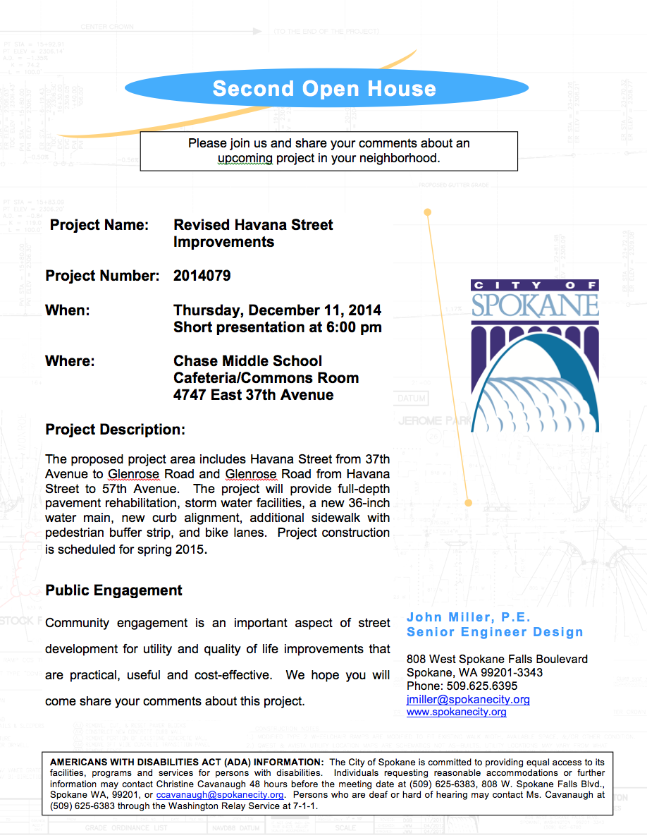

The city’s Engineering Department revealed more details on the Havana Street Water Project and associated 44th Avenue Trail at an open house at Chase Middle School last Thursday. Updates centered on design features of the re-vamped Havana Street and a little more information on the trail. The city has posted a new blog post on this as well.
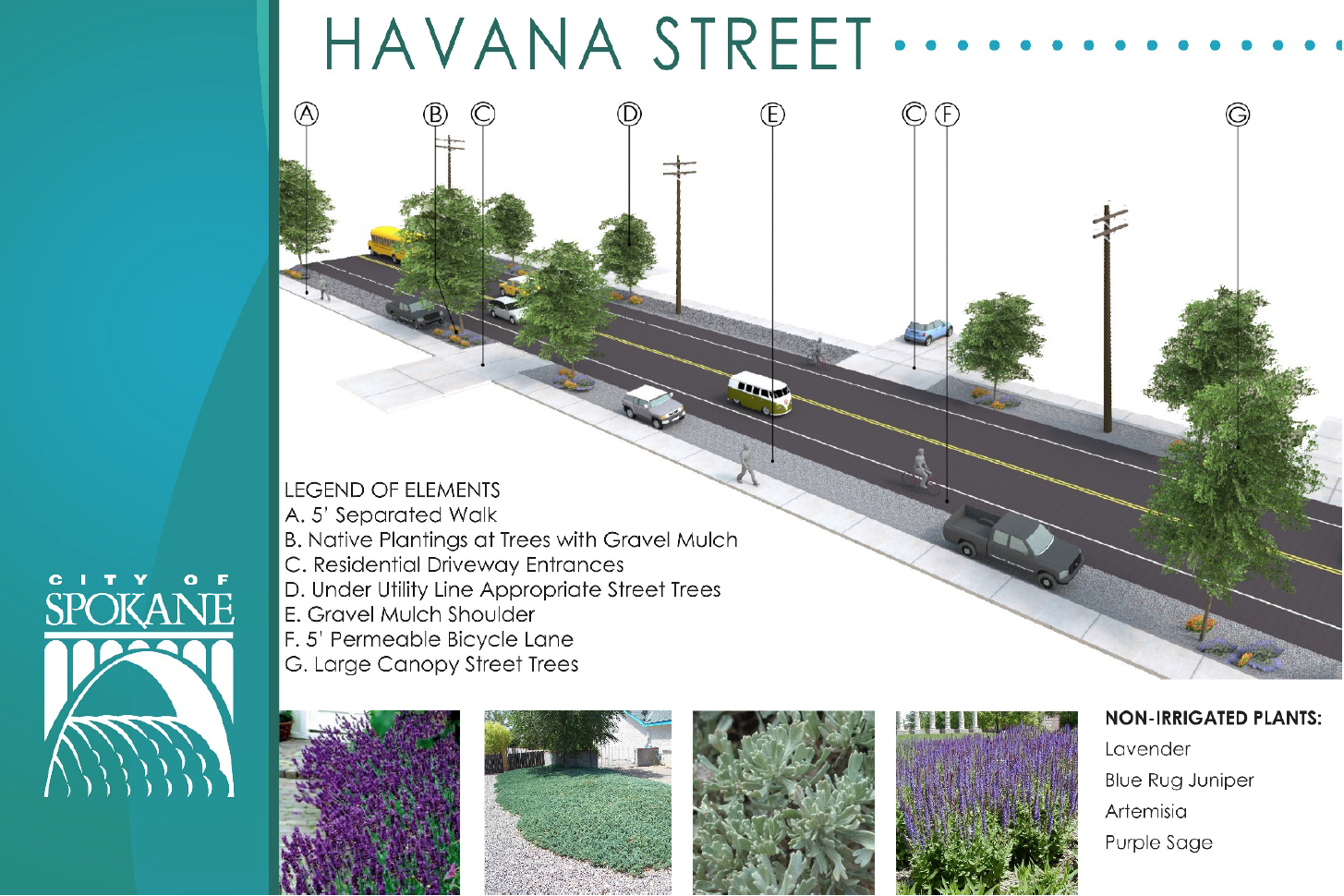
The biggest news is the inclusion of pervious asphalt for the entire length of the new bike lanes from 37th to Glenrose Road. This will be a storm water pilot project for the city, the pervious asphalt will allow run off and snow melt to soak directly into the ground instead of taking up capacity in the city’s storm water system. It’s part of the city’s new goal to adopt low-impact development principles in their planning and engineering.

This also has led to the biggest design changes from the last open house: the elimination of gutters, curbs and planter strips. If you look at the latest cross sections and renderings from the city’s blog post, you’ll see that there are no curbs or planted buffer strips included in the plan, just gravel swales between the sidewalks and the bike lanes. One reason given was to maintain on-street parking for residents living on Havana Street. Another reason was a safety measure for the new pervious asphalt. In the event of a major storm event, or if the pervious pavement doesn’t perform as expected, the gravel swales will allow for excess water to be absorbed into the ground under the swales. This design will also not have any traditional drainage or pipes found in city streets, the city is relying on the natural permeability of the ground to absorb run off (based on a full geotechnical study conducted last spring).
The gravel swales can be planted with trees and low shrubs, but the city is leaving that up to each individual property owner since they are going to rely on the land owners to maintain the plantings. They will install a drop irrigation system to hook into your existing system. Some homes will not be able to have trees due to the Yellowstone petroleum pipeline running down Havana Street.
The County has confirmed that they will complete the portion of Havana from the city limits to Glenrose in the same style as the city’s portion. Once on Glenrose, the County is just going to dig and patch up a small portion of the right-of-way to replace the water main, they will not be adding new sidewalks or creating bike lanes.
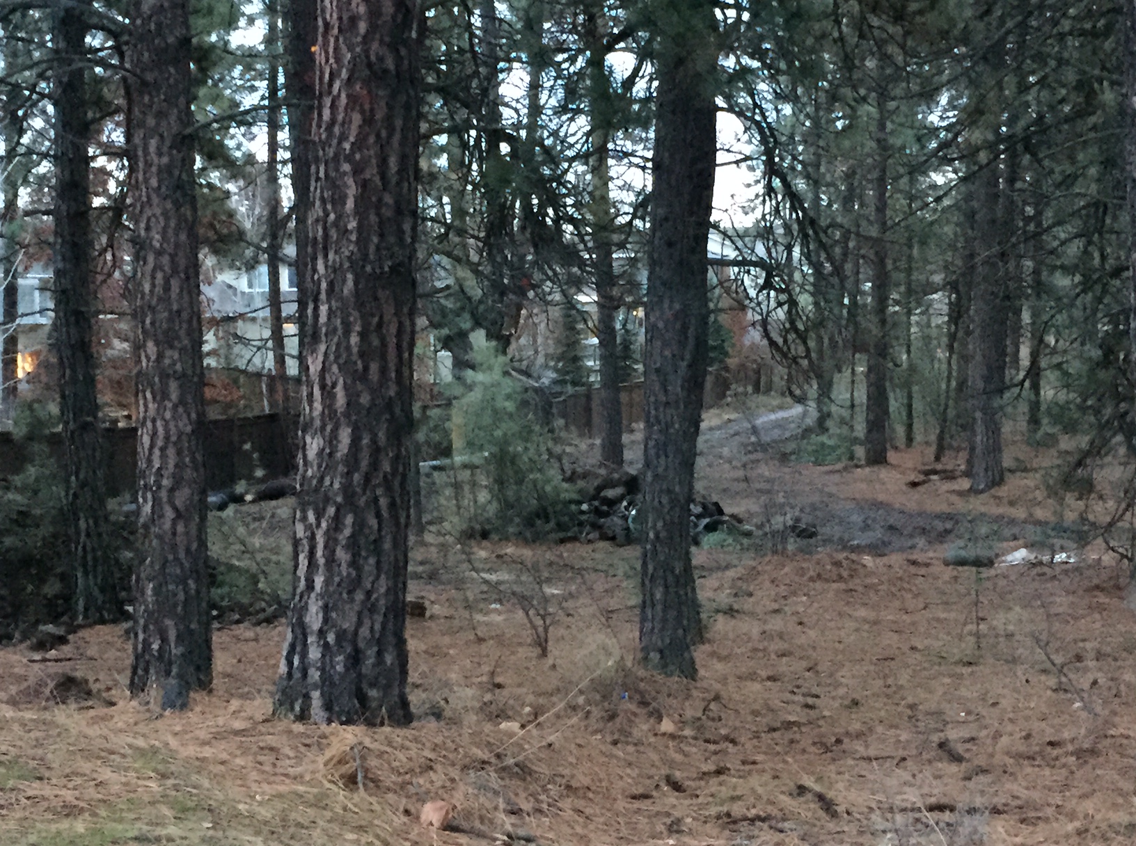
There was some brief news on the 44th Avenue Trail. The city has determined to make the trail 10′ wide (the minimum width allowed by their design guidelines) so it will match the other trails in the area like the Ben Burr Trail. It will be built to American with Disabilities Act (ADA) specs, so it will be paved. They don’t have a final design yet, but they were able to say that they are looking at a meandering, curved path design from Freya to Myrtle, and a more straightened design from Myrtle to Havana to maintain access to back gates along 44th.
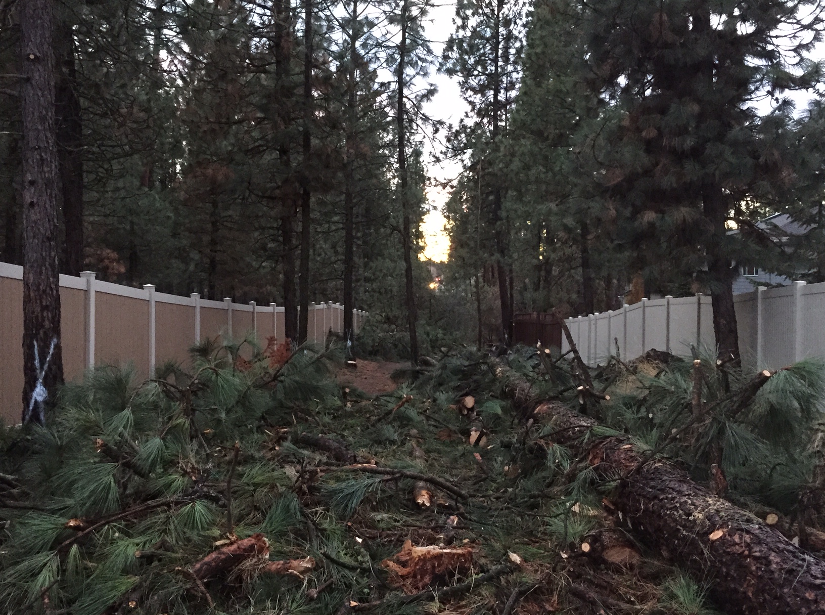
The city reps said they will be replanting native ponderosa pines after the trail work is completed. They are also encouraging neighbors to work with the city’s Urban Forestry Department to talk about replanting areas adjacent to the trail once the work is done. The Southgate Neighborhood Council will work with interested neighbors to submit a Greening Grant to the city for even more landscaping along the new trail. If interested please contact us here.
As before, we welcome your comments here and the city is looking for feedback on their blog as well. You can also email them directly by contacting Julie Happy. We will keep you posted on design updates and any new info as we get it.