
The City is currently updating the Comprehensive Plan through process they are calling Shaping Spokane. Chapter 4 of that update is the transportation chapter. When it was released in late February, we noticed that a particular project had re-appeared in a couple of places: The Ray Street Crossover
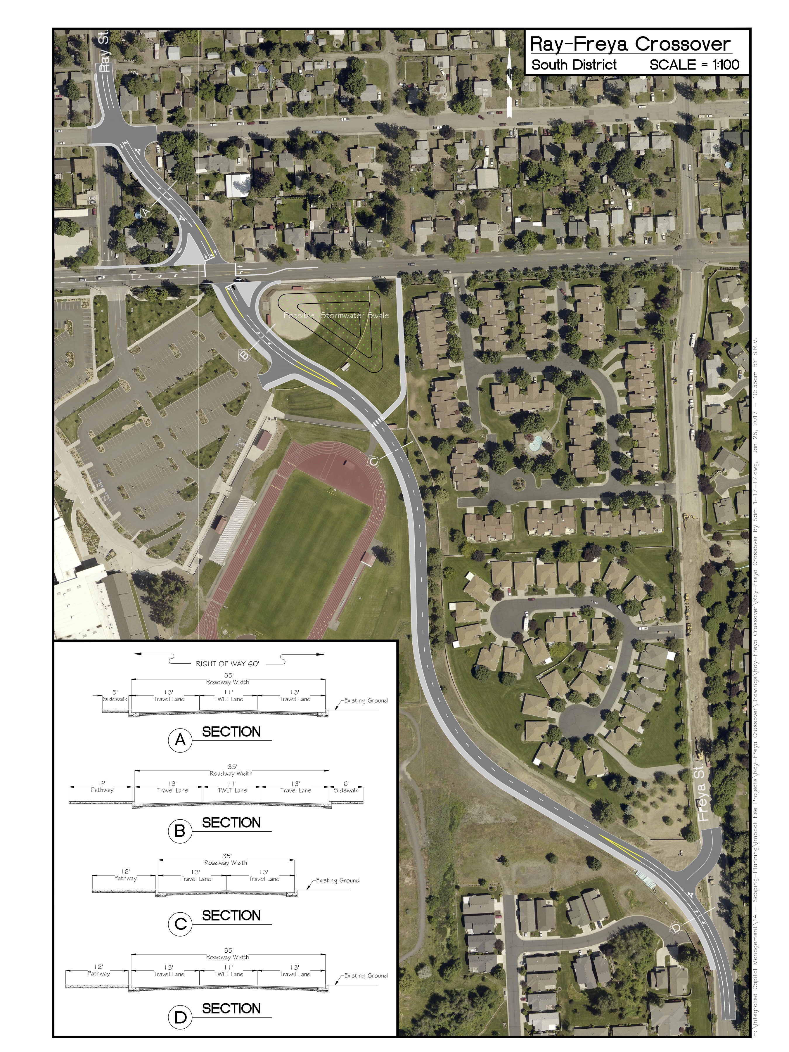
The crossover is a primarily auto-oriented route next to the campus of Ferris High School to speed access of vehicles from Ray Street to Freya Street and out to the Moran Prairie area. The crossover is shown on the arterial network on the draft Arterial Plan Map (Map TR12). This project has also been added to the 2017 DRAFT Capacity Improvement Project List referenced in Chapter 4 and found in Appendix D of Volume V (pg.41) of the new Comp Plan.
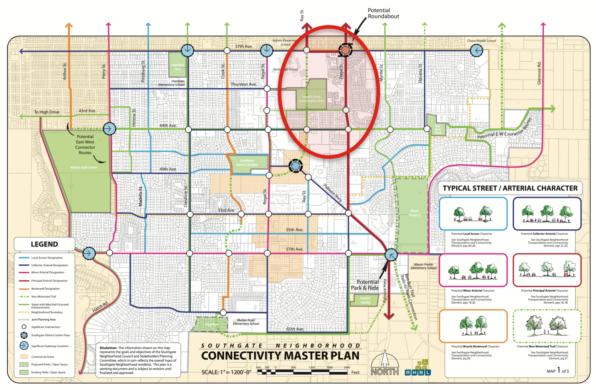
The city is resurrecting this project as a way to reduce perceived vehicular congestion on Regal Street and funnel more traffic over to our neighborhood’s designated Major Arterial, Freya Street. The crossover concept isn’t new. It was last floated back in the early 2000s (and even earlier than that), but was abandoned during the Neighborhood Planning process that took place from 2007 to 2010 because data from the City could not show how this proposed crossover would improve level of service better than signalization improvements to the intersections of 37th and Ray and 37th and Freya. For this reason, and with the concurrence of the then-current Senior Traffic Planning engineer, the city-adopted Southgate Neighborhood Connectivity Plan does not include the Ray Street Crossover (see image below).
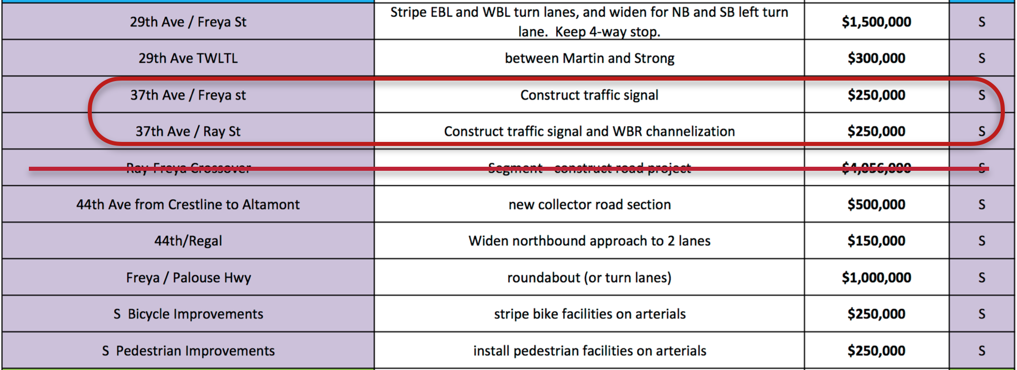
Rather, the Neighborhood Plan suggests signalization improvements at the intersections of 37th and Ray and 37th and Freya to better manage the flow of vehicular traffic. This alternative reduces impacts on Ferris, on Hazel’s Creek and is undoubtedly less costly. The table below is taken from the 2017 Draft CIP List and shows the two signalized intersections are estimated to cost $500,000 where the crossover would cost $4,056,000 and still require a signal and intersection improvements at adjacent intersections.
In addition to putting back in the Comp Plan, the City recently submitted a Roadway Capacity Justification (RCJ) report to the Spokane Regional Transportation Council (SRTC) in an attempt to justify the development of the Ray Street Crossover. The RCJ report ignores the Neighborhood Plan’s recommendations, that is the signal improvements at 37th/Ray and 37th/Freya, and instead just models traffic impacts with and without the crossover.
City staff have told neighborhood representatives that they have the ability to run the transportation model in-house. We requested that this model be run and the RCJ report adjusted to reflect the neighborhood’s preferred solution. The aforementioned 2017 Draft CIP List does include signalization of 37th and Ray and 37th and Freya as projects in the South region (see below).
Until this occurs, the Southgate Neighborhood requested to the Plan Commission and City Council that the proposed crossover be removed from the Arterial Map and 2017 Draft Capacity Improvement Project list until such time as sufficient studies have been done to address the improvements desired in the neighborhood plan. This removal would support proposed TR Goal E of the updated Comprehensive Plan, “evaluate transportation projects using objective criteria to reflect community standards and desires.” (Comp Plan, 2017, pg. 4-15)
South Hill Traffic Management: Assessing the Bigger Picture
In the larger picture, the RCJ report and portions of the draft Comprehensive Plan highlight the need for a more comprehensive assessment of traffic issues on the South Hill. The Southgate Neighborhood and South Hill Coalition have requested a that holistic Traffic Management Study and Plan be developed for the entire South Hill. This plan could assess and provide a context for any and all arterial designations and additions on the South Hill suggested in the new Comp Plan and CIP list:
- The Ray Street Crossover,
- the completion of 44th between Regal Street and Crestline Street,
- and addition of a proposed minor collector between Southeast Boulevard and Crestline Street.
It would help determine how these individual projects and designations align or do not align with the goals of the Southgate and South Hill Coalition Neighborhood Plans. It would help these or any other projects support the existing and proposed Comprehensive Plan’s call for a “Balanced Transportation Approach” that seeks to first accommodate the pedestrian and maintain or enhance the character of neighborhoods and livability for neighborhood residents.
There will be additional hearings on the Comp Plan update at City Council in the next couple of months, so the public will have a chance to comment on this proposal again. We will also keep you updated if the City provides models for the intersections improvements called for in our neighborhood plan. Our Comp Plan and Municipal Code call for balanced, multi-modal translation development in our City, this proposal is geared primarily towards auto-users and a less dramatic, fiscally reduced solution should be considered before putting this into the Comp Plan for the next 20 years.